

Gramvousa app for iPhone and iPad
Developer: Ubicarta
First release : 14 Feb 2018
App size: 28.57 Mb
Gramvousa topoGuide is a digital field guide for hikers and nature lovers visiting Crete. It includes routes, descriptions and photos for 12 hiking and mountaineering trails along the Kissamos, Falasarna, Gramvousa and Balos areas.
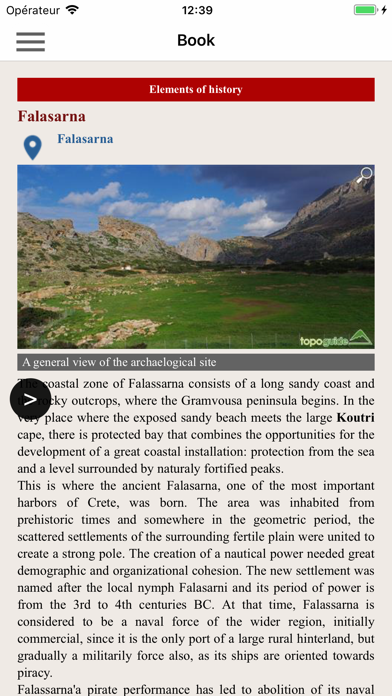
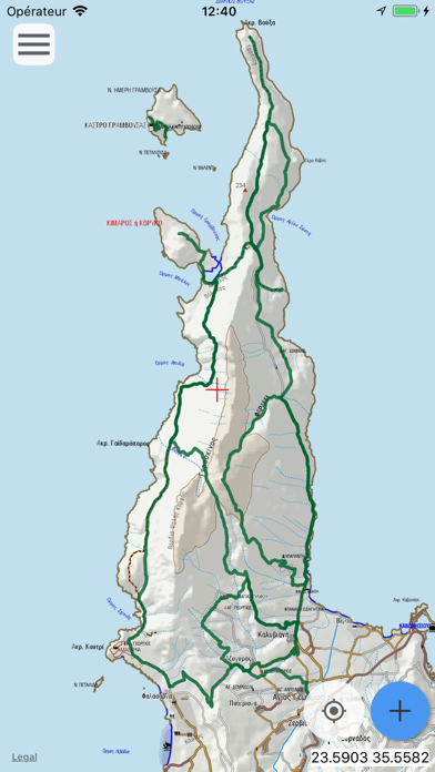
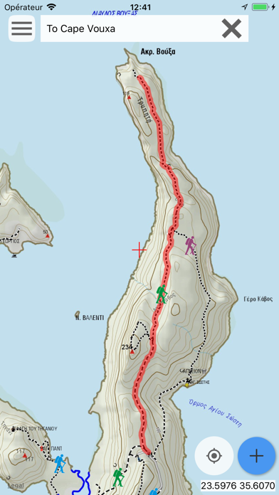
The application offers detailed offline maps and an extensive introduction on geography, geology, the nature and the rich ancient history of Kissamos, Falasarna, Gramvousa and Balos, including a comprehensive presentation of the nature of Western Crete (fauna and flora).
The app offers also a useful list of POIs.
The trails list includes easy and moderate hiking trails and long mountain traverses, of a total length of 60 km.
The cartographic company AnaDigit, creator of the application, has issued previously detailed hiking maps at a scale of 1:25,000 for Crete, as well as hundreds other hiking maps for Greece (eg. maps of Mt. Olympus, Zagori, Sifnos, Naxos and other Aegean islands). To build the application and ensuring data accuracy, all paths of Gramvousa area have been revised during early 2018.